For anyone with a passion for walking and hiking, especially in the UK, Peak District walks have to be near the top of anyone’s list in terms of location and spectacle.
The Peak District covers a vast area of northern England spanning a number of counties including Derbyshire, Cheshire, Greater Manchester, Staffordshire and West & South Yorkshire. With this expansive, wide-ranging geographical area, it is going to offer a wealth of options for those wanting to stretch their legs. Its central location means it’s easily accessible and as such attracts people from all corners of the country.
Here we are going to look at 7 of the most stunning walks you can undertake throughout the Peak District. They cater for all ages and all abilities and all have some incredible sights to see.
Let’s start with:
Thor’s Cave & Manifold Valley
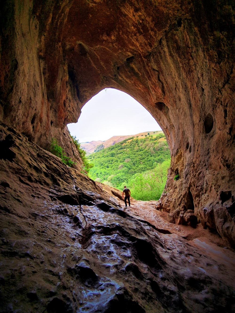
If you like your walking experience with a little subterranean element, then this is the walk for you. Incorporating one of the largest natural caverns in the Peak District, this walk starts in the picturesque village of Wetton and, once you reach the Wetton Mill, you’ll follow an underground river system until you reach Llam.
After that, you’ll get to see some amazing overground sites following the path of the valley between Sugarloaf and Wetton Hill. If there’s been, or a threat of rain, then be careful on the limestone as it can be slippy underfoot.
Start / End Point: Wetton village car park, postcode DE6 2AF
Distance: Approx 9.2 km
Level: Beginners
Castleton – Mam Tor – The Great Ridge
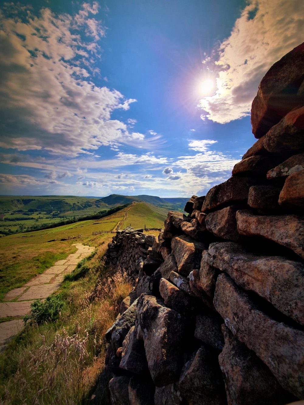
The Mam Tor walking route is one of the most popular walks in the Peak District. It’s a relatively short 6.5 mile walk that starts at Castleton in Derbyshire and allows you to take in some of the most stunning views over Edale.
As you reach the summit of Mam Tor, aka Shivering Mountain, you will witness some incredible views, so make sure you have a camera handy. If you enjoy this route, there’s also an option to extend it for a couple of extra miles, which includes a gorgeous walk by a river to give you the full experience.
Start / End Point: Castleton Car Park, postcode is S33 8WN
Distance: Approx 10.4 km
Level: Beginners
Dovestone Reservoir Circular Route
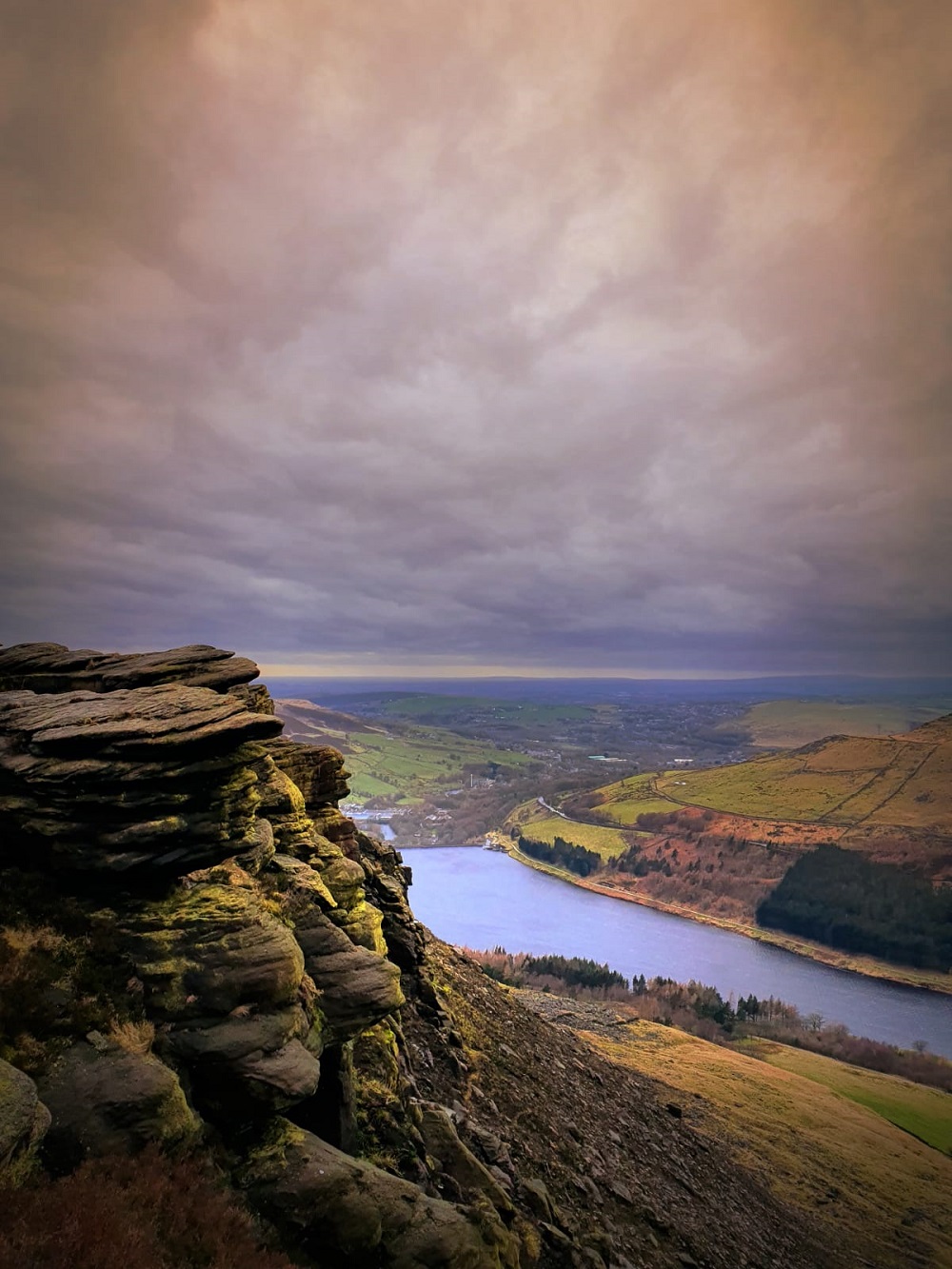
For those of you wanting more of a challenge, the Dovestone Reservoir walk is for you. It’s an 8.8 mile walk that loops around the reservoir and is a haven for those interested in hiking (and bird watching). Whilst the route is a loop, it has an elevation of over 500m, so make sure you pack your sturdiest boots.
If you start with the reservoir on your right, you’ll find yourself climbing up to a stunning waterfall with some great views once on top of the ridge.
Start /End Point: Dovestone car park, postcode is OL3 7NE
Distance: Approx 14.1 km
Level: Intermediate (depending on whether you trek up)
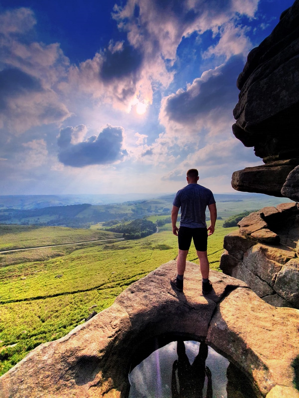
Kinder Scout from Edale
If you’re ready for a challenge, then the walk up Kinder Scout from Edale is going to be perfect for you. It’s the longest walk on this list and is also one of the most popular in the district.
It starts at The Old Nag’s Head in Edale with a gentle start, but don’t be fooled. As it progresses along its almost 11 mile route, you’ll feel the steep incline, but once up there, it pretty much plateaus. When you reach Grindslow Knoll, you see the benefit of your efforts. Although the route seems flat overall, some of the route can be tricky and is troublesome underfoot if you’re not careful.
Start / End Point: Edale car park, postcode is S33 7ZQ
Distance: Approx 17.55 km
Level: Intermediate
Hathersage to Stanage Edge
For those of you who are fans of Charlotte Bronte’s books, this walk takes you through some of the areas that inspired many of them. As you work your way up to the jaw-dropping Stanage escarpment from the historic village of Hathersage, you’ll see some breath-taking panoramas. You might even see some boulderers trying their skills on the rock walls that form part of the walk.
It can get windy on the edge, so be careful if you’re braving the highest points of the walk.
Start / End Point: Heathersage, postcode S32 1DU
Distance: Approx 14.4 km
Level: Beginners
Derwent Edge – Ladybower Reservoir Circular
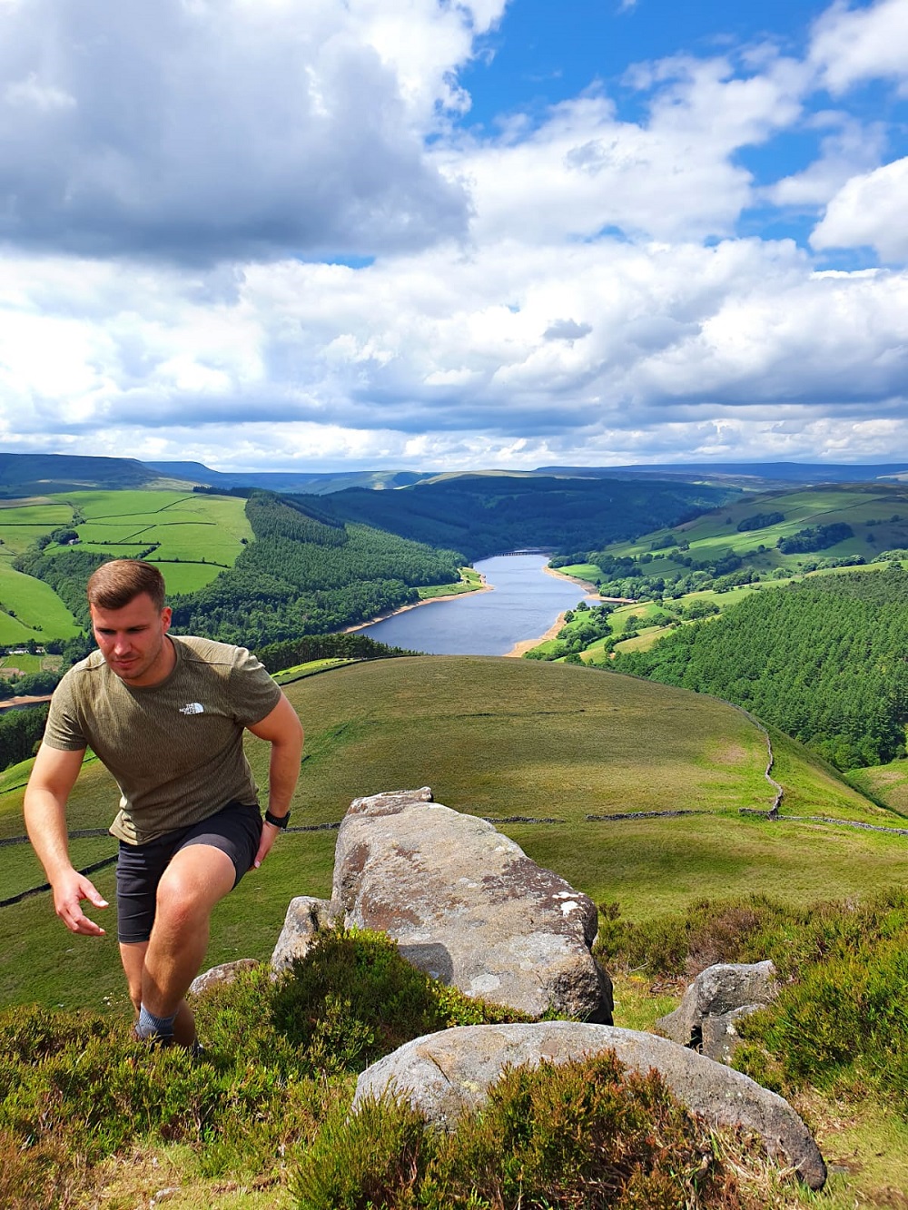
One of the longest walks on this list is Derwent Edge in Derbyshire, looping around almost 16 kilometres along some of the highest peaks in the district. Starting at the Ladybower Inn, take the route uphill along the edge of the Ladybower reservoir (hence the name) with a pretty steep elevation to Derwent Edge.
It’s not really a walk for beginners due to the rocky tors throughout. The route is uneven in places, so care must be taken, but for those willing to challenge themselves, you’ll be treated to simply stunning views throughout the whole route.
Start / End Point: Ladybower Inn, postcode is S33 0AX
Distance: Approx 16km
Level: Advanced (if completing the whole route)
Torside Reservoir
Another great walk in the Peak District revolves around another reservoir, in this case Torside. It forms part of the Longdendale Trail and it’s one that you can do on foot or, if you prefer, you can also take your bike.
It’s a great walk for beginners and, as you get more experienced, you can extend your walk to take in other reservoirs nearby or even include part of the Pennine Way as you head north. Whichever you choose to do, the views you’ll see are incredible throughout.
Start /End Point: Torside Reservoir, postcode SK13 1JF
Distance: Approx
Level: Beginners
If you have any routes or trails to share with us, head over to Instagram and send us a DM.
